by Jacob Oster
It was a little after 7:00pm on the third day of our trip on the Great Allegheny Passage (GAP) and the Chesapeake and Ohio (C&O) Canal Towpath Trails. Josh and I were nearing the end of the C&O trail where it meets the Potomac River in Washington DC. Since passing through Great Falls National Park nearly fifteen miles ago, we’ve been counting down the mile markers. The small brown posts with white lettering mark the miles left of the sandy gravel path next to the tranquil pools, all that remain of the two-hundred-year-old route for commerce. After passing mile marker one, we grow excited, expecting that soon, we will reach mile marker zero (and at last we’ll be able to get out of our sweat-drenched clothes and enjoy some hot food). With about a half mile left, the trail guides us into a brick courtyard in Georgetown, where a musical group is setting up for live music outside a restaurant. The canal continues to our left, but with buildings, parked cars, and slightly amused restaurant patrons around us, there’s no indication of where the trail continues. Josh and I look at each other: “Where is it??”
The GAP and C&O trails, which together span from Pittsburgh, Pennsylvania to Washington DC, are made from the remains of three major transport systems. The GAP was made from abandoned sections of two railways, the Western Maryland Railway (WM) and the Pittsburgh and Lake Erie Railroad (P&LE). It runs 150 miles from Pittsburgh to Cumberland MD. The C&O Canal was the result of the vision of George Washington, who surveyed much of the area along the Potomac River in his early life and realized its importance for encouraging settlement and development of the Ohio River Valley. It spans nearly 185 miles from Cumberland to Washington DC. Combined, the two make up 335 miles of gravel trails for outdoor explorers, which is where we come in.
Josh and I took an Amtrak train from Washington DC to Pittsburgh. We arrived in Pittsburgh around midnight, and stayed at an Airbnb. We began biking the next morning at Point State Park at the fountain where the Allegheny and Youghiogheny Rivers meet to form the Ohio River, the start of the GAP. We biked roughly 106 miles along the Youghiogheny river to the town of Rockwood. The trail was in excellent shape, some sections were maintained by local volunteer groups, and one section even had a paver placing fresh, very fine grain gravel down! We checked in at the Husky Haven Campground office where we hosed off the bikes, showered, and then headed to the campground for the night.
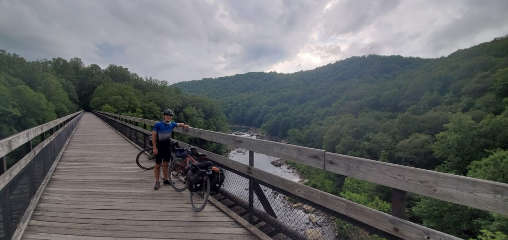
The next day, we covered nearly 115 miles as we crossed the Continental Divide separating the Gulf of Mexico watershed from the Chesapeake Bay Watershed, passing through Cumberland (after having some delicious food at the Rock of Ages Christian Restaurant and Night Club, it did not disappoint). Taking the advice of a cyclist we met near the continental divide, Josh and I took State Route 51 from Cumberland to Spring Gap and the Western Maryland Rail Trail from mile marker 135 to Hancock, thus avoiding some rough patches on the C&O and making better time. We journeyed through iconic tunnels, including the Great Savage Tunnel and Paw Paw Tunnel. We finally reached Fort Frederick State Park, MD around 9pm and collapsed for the night at one of the hiker-biker campsites.
The final day, we covered 110 miles. We dodged a storm the previous day, but the trail ahead of us had not, with nearly a dozen trees blocking our path at various parts of the trail. Nevertheless, we passed Antietam National Battlefield, checked out some caves, had lunch in Harpers Ferry, took some pictures of Great Falls, and now found ourselves in Georgetown, but with no mile marker zero. Based on what we had seen in Point State Park back in Pittsburgh and at the meeting of the GAP and C&O in Cumberland, we expected some sort of impressive monument to indicate the end of our journey (and take pictures with). But there was nothing in sight in the square we now found ourselves in.
Josh asked the DJ of the music group where the mile marker zero was, and the DJ directed us down the street to the waterfront. We reached the Potomac River near the Georgetown Waterfront Park, but still saw nothing indicating the C&O Towpath, so we flagged down a local cyclist. He led us to the Capital Crescent Trail, a paved path that runs along the C&O trail for the last 2.5 miles, but the path had no mile marker on it. So we returned to the waterfront and Josh asked for directions from a boat rental store near the end of the Crescent trail. The attendant didn’t know of it either, but he let Josh use his computer to narrow down our search pattern.
We returned to the brick square, crossed the footbridge to the other side of the canal where we picked up the tow path again (though now it’s only three feet wide in some spaces, with weeds overgrowing the sides of the path) and followed the path to where it meets Rock Creek Path. We followed Rock Creek Path to where it meets the Potomac. I saw a giant sundial monument in a plaza to my right, and began investigating it. I’m still not sure why I thought at the time a sundial would have anything to do with the C&O canal, but as I’m ready call it a selfie and be done with it, Josh emerged from his search behind Thompsons Boatyard to our left, shouting that he found it. We entered the vacant lot to the side of Thompsons boatyard, and there, in an unceremonious patch of dirt surrounded by a few scabby patches of grass, with no fanfare or to-do whatsoever, was a simple granite column, maybe three feet tall and , that simply says , “Mile 0”. We did it, all 335 miles of it, and in three days.
Helpful links:
GAP Trail Map https://gaptrail.org/explore/interactive-map
C&O Trail Maps https://www.nps.gov/choh/planyourvisit/maps.htm


