Contributed by Casey Fenton
The PA Forests have been busier than ever, so I've been looking for some roads less traveled - and this route hits the target. This course sits just north of the unPAved Route in the Bald Eagle State Forest between Rt. 192 and Interstate 80. For those familiar with unPAved, these roads have a similar surface: old, hardpacked gravel with some loose stuff in the corners and on the crown of the road. The climbs are not quite as long or high as unPAved, but they can be punchy.
There are a ton of options in this area, but this route is a 37 mile loop beginning and ending in RB Winter State Park, where you can find restrooms and water (in the warmer months).
You start with a gradual climb up Sand Mountain road that gets a bit steep toward the top. The downhill on Cooper Mill is steep and twisty, but then you turn onto a more gradual descent along Spruce Run. Spruce Run is my idea of a perfect gravel descent. It's long, straight, and gradual. You can hit 35 mph with minimal pucker.
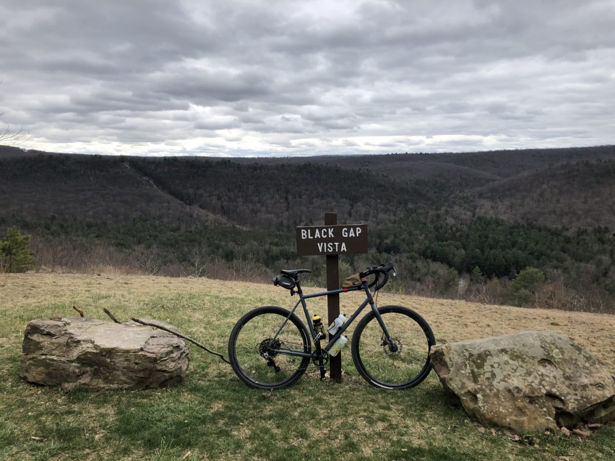
The climb up Running Gap is challenging, but it's not too long and then it's downhill to White Deer Creek Road. I'm no fisherman, but if you're into that, this is the place to break out the rod. White Deer Creek Road climbs very gradually before you hit some steep rollers on Garden Hollow, Breon, and McCall Dam. Before you start descending McCall Dam, turn right on Engle for about a half mile to check out Black Gap Vista. You could continue on Engle and reconnect at the bottom of the hill (this option would cut the route down to about 30 miles). But sticking to the 37 mile route we'll go back to McCall Dam Road and descend down to McCall Dam State Park.
McCall Dam State Park is really more of a picnic area. There are restrooms, but I've never seen them unlocked and there is no potable water. But the park is worth cruising through especially if you're looking for some fishing spots. Climbing back out of the park, still on McCall Dam Road, you'll reach Black Gap Road just before you hit the summit. Black Gap is one of the prettiest roads in Pennsylvania in my opinion and it meanders slightly downhill through some old Pine Forests. Nice gradual up and downs await on Engle and Tunis before you intersect with Rt. 192 at the 35 mile mark. From there, it's just 2 miles on some hardtop back to R.B. Winter, where you can cool off in one of PA's most beautiful Mountain Lakes.
I think this route is a nice survey of an underutilized section of the Bald Eagle State Forest. You can connect it to hundreds of miles of gravel roads to the North (in Tiaghdaton State Forest) or the South (through unPAved country). There are no water or food stops along the way, but if that's a concern you could start in the middle (I would suggest the intersection of Breon and Garden Hollow) and that would put R.B. Winter closer to the middle of the route to fill your bottles. You can also run the route in reverse, though I find the climbing to be a bit more painful in that direction. Camping is available at R.B. Winter State Park for a nightly fee, but there are a bunch of primitive car camping spots along and near the route that are free with a reservation. It's definitely worth picking up a Purple Lizard Map of Bald Eagle State Forest to locate good camping and chart other routes.
RideWtihGPS Route Link: https://ridewithgps.com/routes/33681525


